D&L Trail
- Surface Asphalt, Crushed Stone/Cinder, Dirt/Grass, Gravel
- Length 140 mi
- Width 8 ft
- Grade 8°
Eastern Pennsylvania’s D&L Trail currently spans about 140 miles through the Delaware & Lehigh National Heritage Corridor from Bristol, in the Greater Philadelphia region, to Mountain Top, nestled in the Appalachians. When complete, the D&L Trail will provide over 165 miles of trail from Bristol to Wilkes-Barre; approximately 40 of those miles are within Lehigh and Northampton counties as part of THE LINK. The entire trail jumps back and forth between historic railbed and canal towpath following the path of coal, steel and other materials from the Anthracite mines of Luzerne and Carbon counties to Bristol and the port of Philadelphia.
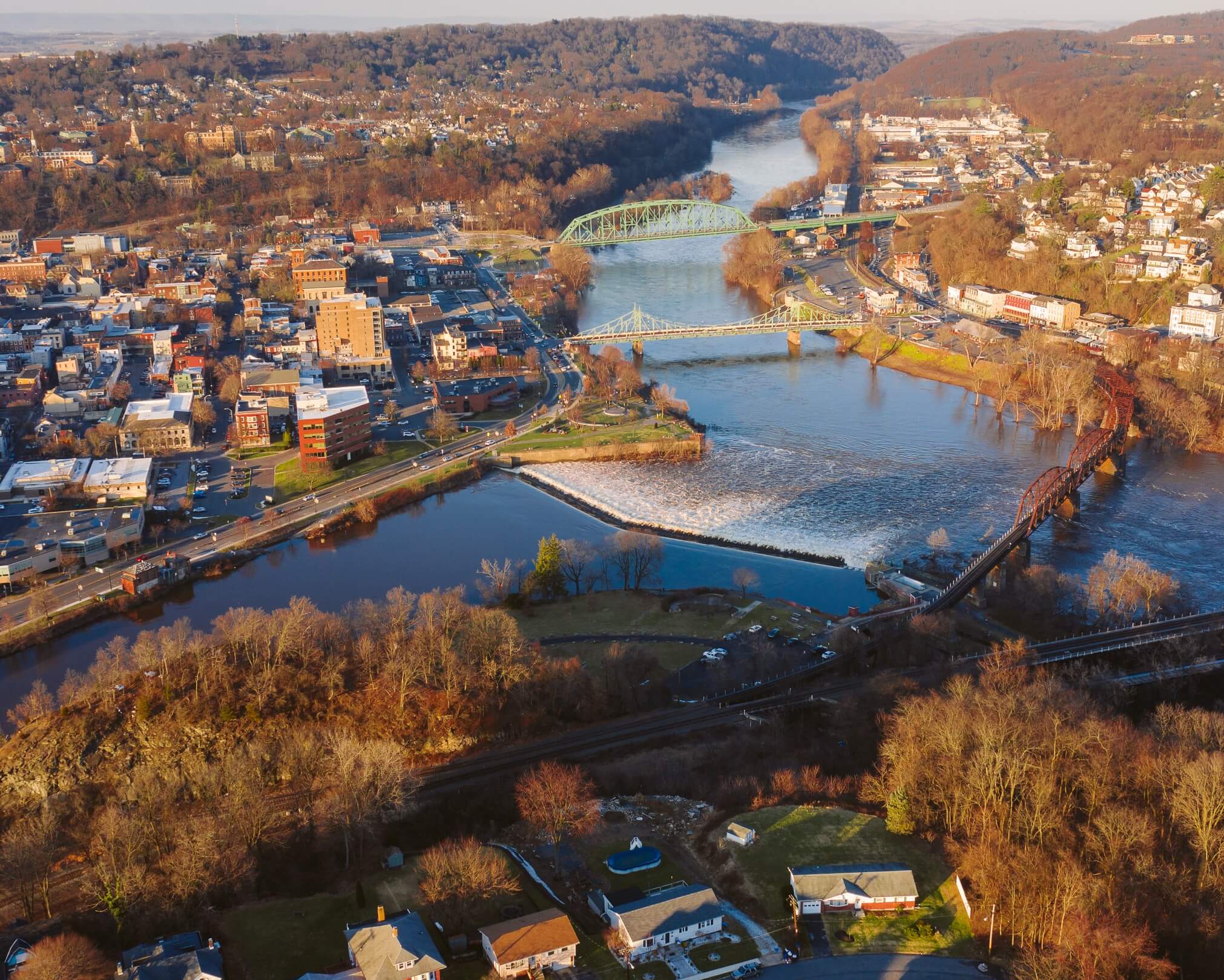
The D&L Trail enters THE LINK region at the Northampton County border close to mile marker 53 along the Delaware Canal and heads north past Wy-Hit-Tuk County Park on the way to Easton. In Easton, the Delaware River meets the Lehigh River and the trail turns west to follow the Lehigh. From the confluence of the two rivers, the trail is paved for its first few miles before reverting to the usual crushed-stone surface as it traverses Bethlehem and continues on to Allentown, the two largest cities on the D&L Trail. This 13-mile section is sometimes referred to as D&L Trail: Lehigh Canal South. History buffs will enjoy the trail’s passage through Easton’s Hugh Moore Park, home to the National Canal Museum and a mule-powered canal boat called the Josiah White II.
Farther on, another not-to-miss attraction is the Freemansburg Canal Education Center, located in a restored mule barn from 1829. The historical site features a canal lock, locktender’s house and the ruins of a grist mill. As you pedal through neighboring Bethlehem, you’ll have a look at the impressive Bethlehem Steel stacks across the river. The site of this industrial powerhouse—once one of the largest steel manufacturers in the country—is now home to a popular entertainment and cultural events venue. In Allentown, the trail currently ends at Lehigh Canal Park (mile marker 75), a great spot for a picnic with a pavilion, grills and restrooms.
There’s a 7-mile gap before you can pick up the D&L Trail again in Northampton at Canal Street Park. It’s worth noting that the Nor-Bath Trail intersects the D&L Trail here and across the river from this park, there’s another phenomenal rail-trail to explore, the Ironton Rail-Trail, in Coplay that passes hauntingly beautiful old cement kilns reaching toward the sky, the last ones standing in the U.S.
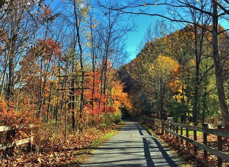
The D&L Trail segment going north from Northampton is known locally as the Asher F. Boyer Trail, named in memory of an Eagle Scout. This section continues the journey along former railbed on a northwestern trajectory to Slatington, a distance of nearly 11 miles. The crushed-stone pathway meanders through lush forests and along towering rock cliffs with breathtaking views of the Lehigh River.
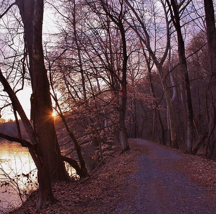
In Slatington, there is a hub of trail connections. For a side excursion, you could cross the river on the Main Street bridge (there are sidewalks flanking the roadway) to reach a 4-mile stretch of earthen canal towpath on the river’s east side that forms the D&L Trail: Walnutport Canal Spur. There’s also an opportunity for checking out the Slate Heritage Trail, which connects to the D&L and travels west for just over 3 miles on abandoned railbed along the wooded Trout Creek. If you stay on the main path of the D&L Trail along the western bank of the Lehigh River, you’ll reach Lehigh Gap Nature Center near mile marker 94 after 4.5 miles and intersect the Appalachian Trail as you go through Lehigh Gap into Carbon County.
Trail map
See this trail on the map. Tap a marker for details and directions.
Open interactive mapTrail guide
- Surface
- Asphalt, Crushed Stone/Cinder, Dirt/Grass, Gravel
- Date opened
- January 1, 1988
- Trail type
- Multi-Use
- Length (open)
- 140 mi Mile numbers 52 to 94.5 are part of THE LINK
- Length (planned)
- 25 mi
- Width
- 8 ft
- Grade
- 8°
- Public restrooms
- Available
Trail access points
This list is only some of the D&L trailheads focused on the ones with largest parking areas or key amenities. For a map of all trailheads, visit https://delawareandlehigh.org/map/ and click on the mountain icon in top left to turn on the trailhead dots.
Wy-Hit-Tuk County Park (D&L mile 56.5)
40.669772, -75.184061
Parking: 35 spaces
ADA Parking: 2 spaces
Amenities: pavilion, flush toilets, playground
Hugh Moore Park (D&L mile 61.2)
2750 Hugh Moore Park Road, Easton, PA
Parking: 50 spaces
ADA Parking: 6 spaces
Amenities: National Canal Museum, seasonal bike and boat rentals, bike repair station, seasonal flush toilets, pavilion, playground, dog park
Palmer Riverview Park (D&L mile 61.8)
40.666218, -75.241490; near 1510 Lehigh Drive, Easton, PA
Parking: 100+ spaces
ADA Parking: 5 spaces
Amenities: seasonal port-a-john toilet, bike repair station, pavilion, playground, baseball fields
Route 33 Boat Launch (D&L mile 64)
40.645517, -75.271905; access from Hope Road, Bethlehem Township
Parking: 50+ spaces
ADA Parking: 2 spaces
Amenities: seasonal port-a-john toilet, boat launch for Lehigh River Water Trail
Bethlehem Sand Island (D&L mile 71)
100 River Street, Bethlehem, PA
Parking: 45 spaces
Amenities: seasonal bathrooms, playground, Charles Brown Ice House (events), tennis and basketball courts,
Allentown Lehigh Canal Park (D&L mile 75)
40.599220, -75.449592; access from East Walnut Street, Allentown, PA
Parking: 20 spaces
Amenities: seasonal bathrooms, pavilion, boat launch for Lehigh River Water Trail
Northampton Canal Street Park (D&L mile 81.5)
40.680130, -75.497422; near 1400 Canal Street, Northampton, PA
Parking: 50+ spaces spread across a few parking lots
Amenities: seasonal flush toilets, connection to Nor-Bath Trail, pavilion, playground, baseball field, tennis and basketball courts
Slatington (D&L mile 92)
40.752616, -75.604716; near 88 Main Street, Slatington, PA
Parking: 35 spaces
ADA Parking: 1 space
Amenities: flush toilets, bike repair station, pavilion
Municipalities connected
Allentown, Bethlehem, Bethlehem Township, Catasauqua Borough, County of Lehigh, County of Northampton, Easton, Freemansburg Borough, Hanover Township, North Catasauqua Borough, North Whitehall Township, Northampton Borough, Palmer Township, Walnutport Borough, Washington Township, West Easton Borough, Whitehall Township, Wilson Borough
Connected trails
Trail rules
Trail rules vary by landowner. The D&L Trail is owned by multiple landowners, mostly municipalities, a few non-profit organizations, and PA Department of Conservation and Natural Resources; none of the D&L Trail is owned by Delaware & Lehigh National Heritage Corridor.
Future trail plans
There is an 8 mile gap in the D&L Trail between Allentown and Cementon/Northampton. Development plans include building trail on both sides of the Lehigh River between the Hamilton Street Bridge and the Cementon-Northampton (Rt 329) Bridge.
Notices and safety information
For more information about the Delaware & Lehigh National Heritage Corridor and D&L Trail, visit https://delawareandlehigh.org/.
For maps, use the interactive online trail map with status of each trail section at https://delawareandlehigh.org/map/ or find the printable trail brochures for each D&L Trail region (Anthracite Region, Lehigh Valley Region, and Delaware Canal Region) at https://delawareandlehigh.org/trailmaps/.
On the trail
